Building land in Manfredonia (FG) - SHARE 6/36
Manfredonia (FG)
Building land in Manfredonia (FG), Strada Provinciale 57 - SHARE 6/36
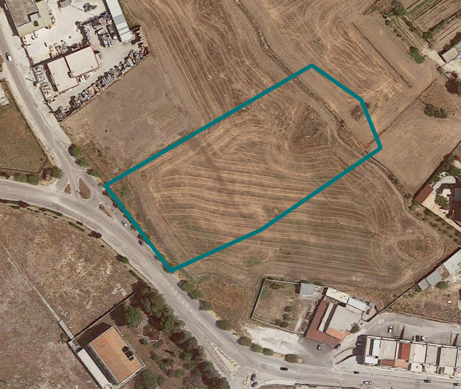
The land as a whole constitutes a building area inserted in a peripheral urban context under development, almost completely urbanized, with the presence of various old and new buildings. The presence of the SP 58 ensures road connections both with the provincial capital and with the other towns whose territory borders that of the Municipality of Manfredonia. Furthermore, it has been ascertained that the area (healthy and far from industrial settlements) is already equipped with infrastructures and services that constitute the primary urbanization works (road network, water network, sewage network, public lighting, municipal solid waste collection service, etc. ..).
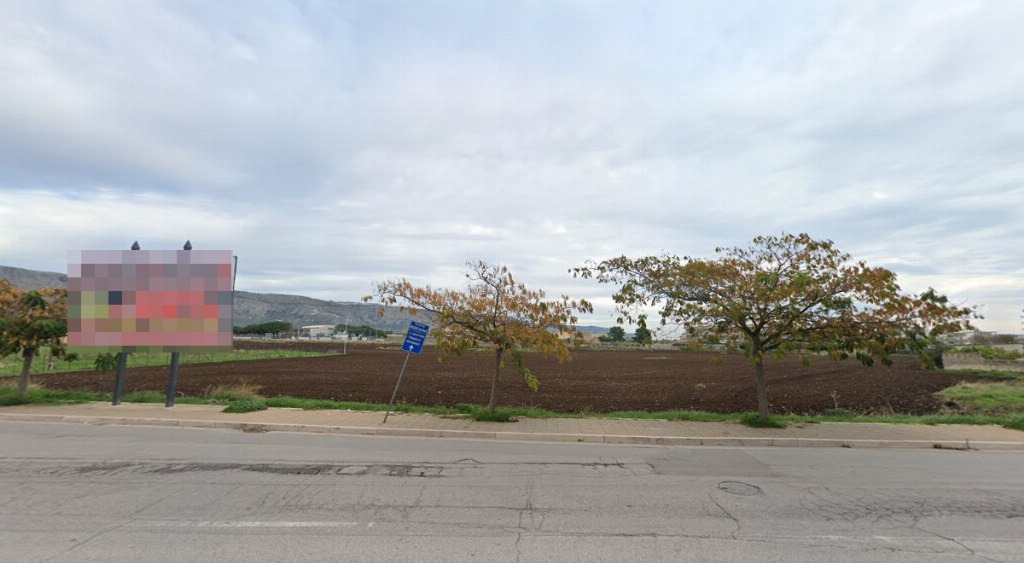
These lands, bordering each other, are located in the peripheral built-up area of the town of Manfredonia and precisely in the locality of Scaloria, close to the S.P. 58 in a northwestern direction towards San Giovanni Rotondo.
Overall, the two parcels make up a rectangular lot with a flat course which borders on the South-West side with S.P. 58 and for the remaining sides with other land as indicated in the relative appraisal of the architect. Morganella dated 7/28/2022.
Ultimately, the estimate in question concerns land completely free from constraints and with the peculiarities set out above, usable for building purposes as foreseen by its destination according to the urban planning instrument of the Municipality of Manfredonia.
The land in question for the analytical description of which is referred to the report of the Arch. Morganella dated 23/9/2021 which is an integral part of this notice, fall within, as reported in the Certificate of Urban Destination in the Urban Planning Completion and Adjustment Area with the quantities shown in the table referred to in the appraisal and divided as follows:
• Territorial Homogeneous Zone CB8;
• Territorial Homogeneous Zone CB2;
• VP area (Public and sports green)
• PRG viability
The implementation tools of the PRG for the Zone of completion and urban adaptation are: Zone Plans, Detailed Plans and Affiliated Subdivisions and construction through the direct intervention of a single owner is not envisaged.
The construction is expected in compliance with the following indices reported in the Certificate of urban destination:
• district index 0.65 m3/m2
• territorial index (housing + services) 0.75 m3/m2
• maximum number of floors above ground n° 4
• maximum height required: 14.00 m
• Admitted building typology: Isolated multi-family buildings, Continuous multi-family buildings, Terraced houses, groupings of single units, Special buildings.
It should be noted that as reported in the Certificate of urban destination issued by the Municipality of Manfredonia prot. 41164 the volume due and achievable relating to the land surfaces falling within the CB2 Section have already been created and included in the "Gozzini" Integrated Plan Intervention pursuant to Municipal Council Resolution No. 22 of 02/07/2013.
Therefore the volume due for the building area appears to be only the area falling within the CB8 Territorial Homogeneous Zone.
CADASTRAL DATA
PORTION OF LAND 1:
Municipality of Manfredonia Sheet 23 parcel 464
Sheet 23 - Parcel 464 - Arable land quality - class 2 - area sqm 5000 - R.D. € 20.66 - R.A. € 12.91
Total particle area of about 5,000 square meters.
Pertinencial Surface area of approximately 79.33 square meters.
Estimated value €1,785.00
PORTION OF LAND 2:
Municipality of Manfredonia Sheet 23 parcel 1375
Sheet 23 - Parcel 1375 - Arable land quality - class 2 - Sup m2 4723 -R.D. € 19.51 - R.A. € 12.20
Total area of approximately 4,723 m2.
Pertinencial Surface area of approximately 180.92 square meters.
Estimated value €4,071.00
 Italiano
 English
 Français
 Español
 Euskara
 Català
 Deutsch
 Nederlands
 Português
 Shqiptare
 Български
 Čeština
 Ελληνικά
 Hrvatski
 Magyar
 Македонски
 Polski
 Română
 Српски
 Slovenský
 Slovenščina
 Türkçe
 Русский
 Dansk
Dansk Suomalainen
 Íslenskur
 Norsk
Norsk Svenska
 Lombard
 Marchigiano
 Pugliese
 Romano
 Siciliano
 Toscano
 Veneto