 Italiano
 English
 Français
 Español
 Euskara
 Català
 Deutsch
 Nederlands
 Português
 Shqiptare
 Български
 Čeština
 Ελληνικά
 Hrvatski
 Magyar
 Македонски
 Polski
 Română
 Српски
 Slovenský
 Slovenščina
 Türkçe
 Русский
 Dansk
Dansk Suomalainen
 Íslenskur
 Norsk
Norsk Svenska
 Lombard
 Marchigiano
 Pugliese
 Romano
 Siciliano
 Toscano
 Veneto

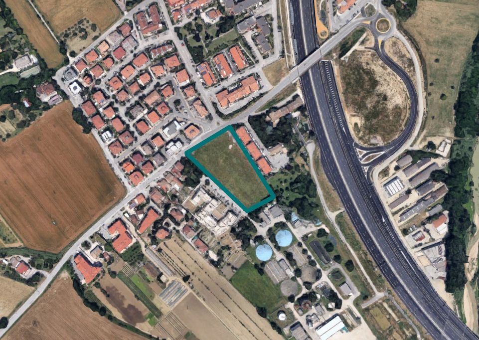
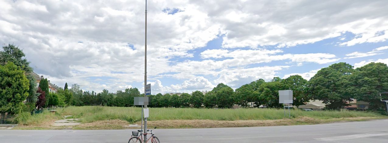
AT AUCTION Land in Senigallia (AN), Via Pò - LOT SE T001 - OFFER COLLECTION
The land at auction is located in the western peripheral area of the town of Senigallia, uphill from the A/14 highway and near the highway exit
It has an area of 7,682 sqm.
The urban planning designation of the land plot as per variant of cc. n. 52 of 30-7-2019, is as follows
sheet 27, parcel 1061 of cadastral sqm. 7659 falls:
- for m² 7,229, homogeneous territorial zone E - agricultural urban area art. 19 of the N.T.A.;
- for m² 315, homogeneous territorial zone BR1 – completion urban area art. 16 b, of the N.T.A.;
- for m² 115, homogeneous territorial zone BR3 – pertinent areas and private courtyards art. 16 d, of the N.T.A.;
sheet 27, parcel 1067, of cadastral m² 23, falls entirely in:
-- urban area communication lines art. 13 of the N.T.A.
It is specified that:
- parcel 1061 of sheet 27, falls within the basin plan for the hydrogeological arrangement of regional relief basins (PAI), as flood-prone areas at risk R3.
- For changes to the urban planning designation, the safeguard rules to the PRG are in place, for part of parcel 1061 of sheet 27 falling in homogeneous zone B "BR3" and for pertinent areas and private courtyards.
Land Registry of the Municipality of Senigallia at Sheet 27:
Parcel 1061 - 1067
For further information, consult the appraisal and attached documentation.
Retail surface: 7682 sqm
Lot Code: SE_T001