 Italiano
 English
 Français
 Español
 Euskara
 Català
 Deutsch
 Nederlands
 Português
 Shqiptare
 Български
 Čeština
 Ελληνικά
 Hrvatski
 Magyar
 Македонски
 Polski
 Română
 Српски
 Slovenský
 Slovenščina
 Türkçe
 Русский
 Dansk
Dansk Suomalainen
 Íslenskur
 Norsk
Norsk Svenska
 Lombard
 Marchigiano
 Pugliese
 Romano
 Siciliano
 Toscano
 Veneto


Agricultural land in Brindisi - LOT 7
Land Registry of the Municipality of Brindisi at
Sheet 153 – Parcels 89 - 133 - 90 - 219 - 92 - 412 - 91
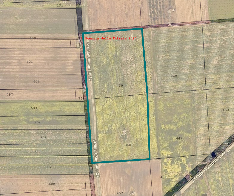
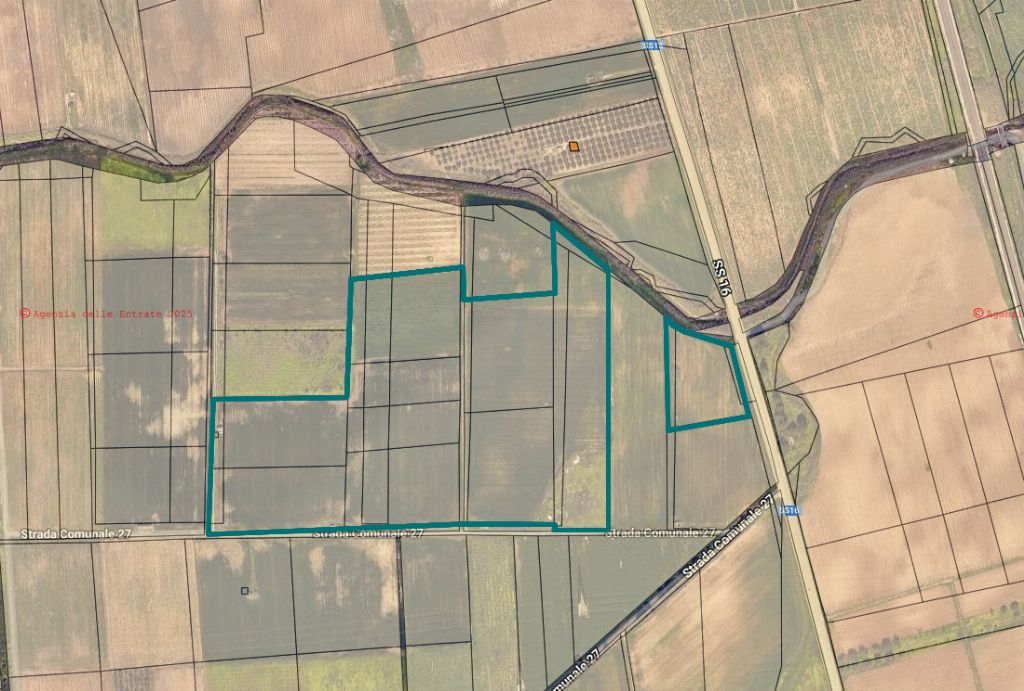
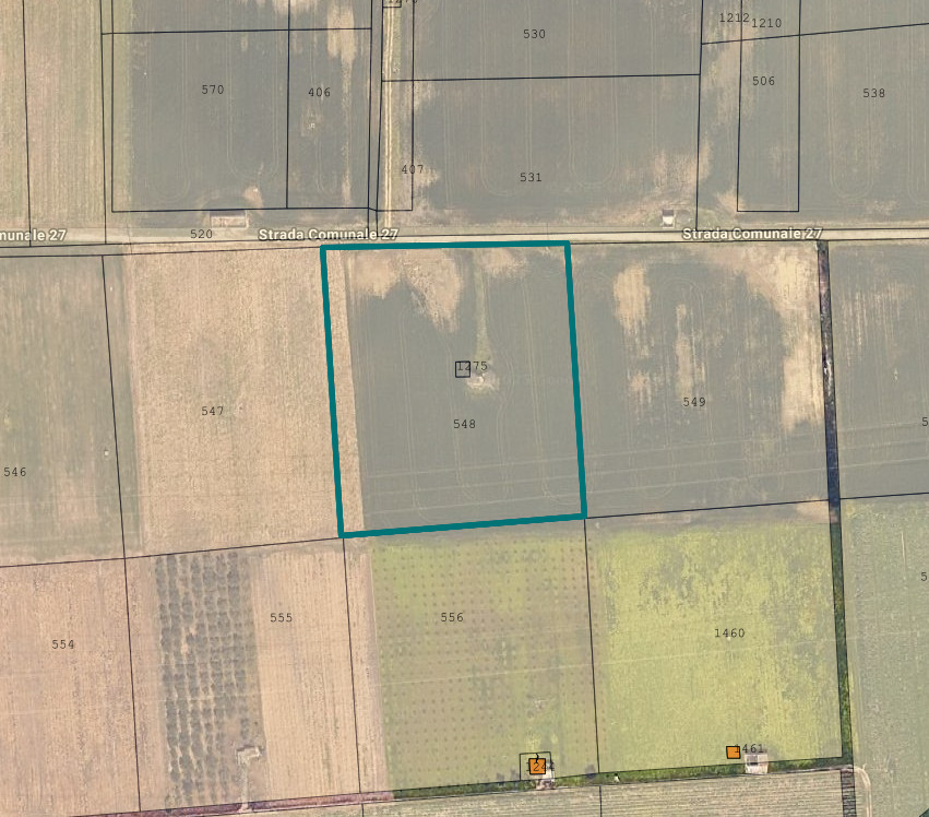
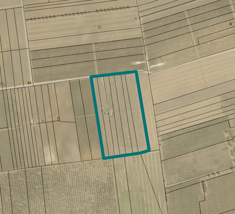
Sheet 163 - Parcels 407 - 531 - 1209 - 1211 - 1210 - 1212 - 1213 - 1214 - 405 - 530 - 548 - 1275 - 1276 - 439 - 448 - 509 - 537 - 535 - 506 - 538 - 389 - 396 - 507 - 511 - 539 - 543 - 508
The lands subject to this work are classified according to the current urban planning tool: "Zone "E1" - Agricultural" where the construction of new buildings is allowed exclusively for interventions related to the development of agriculture, with a minimum lot of Ha 00.50.00 and a building index of 0.03 mc/mq.
They have the following agricultural destination:
a) Dry Crops
The dry crop lands are all excellent from a production point of view. Except for one plot of vetch, they are all mainly intended for durum wheat, with a blend of Cv. "Brigante" averaging about 75% and Cv. "Acadur" averaging about 25%.
a) Dry and Irrigated Crops
The irrigated crop lands are mainly intended for the cultivation of artichokes; there are also destinations for cauliflower and lands being prepared for spring-summer vegetable crops.
All lands with this agricultural destination are found to be illegally cultivated by third parties.
There are dilapidated farmhouses, once homes and storage for agricultural tools. Except for two structures, built to host photovoltaic plant control units.
All are found to be without any municipal authorization and were mainly built before 1967, except for two structures, built recently to host photovoltaic plant control units.
Some were built with the Reform Authority and subsequently expanded before being abandoned.
For further information, please consult the appraisal and the attached documentation.
Area: 142.831 sqm