Lands in Acireale (CT)
Acireale (CT)
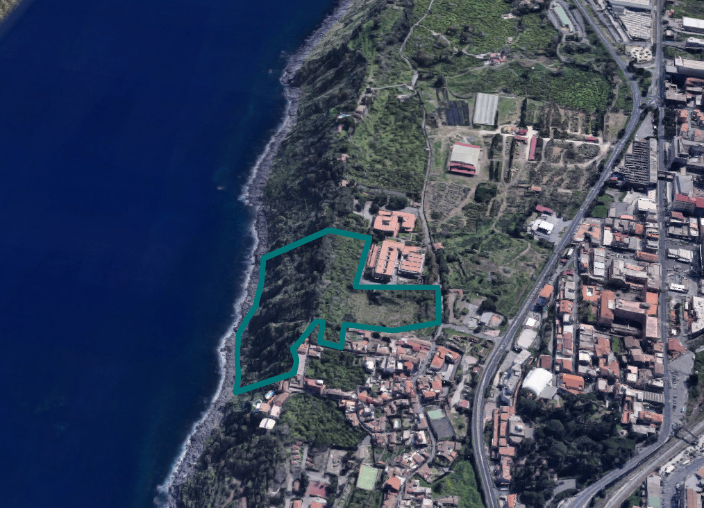
Lands in Acireale (CT), Località Santa Caterina, Via Madonna delle Grazie s.n.
The lands are registered at Land Registry of City of Acireale at sheet 68:
Particles 55 - 56 - 310 - 431 - 432 - 433 - 675 - 677 - 678 - 679 - 680 - 681
Overall land covering approximately 43,589 square meters, easily reachable along the Strada Statale 114 in a northerly direction until you come close to the village of Santa Caterina where the entrance to the property is located on the roadside of Via Madonna delle Grazie.
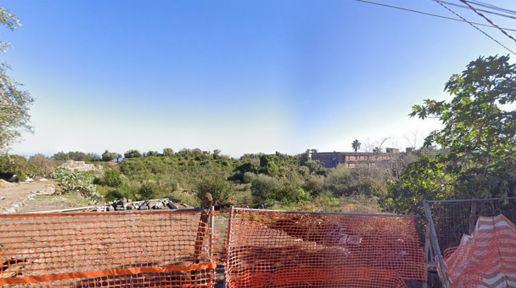
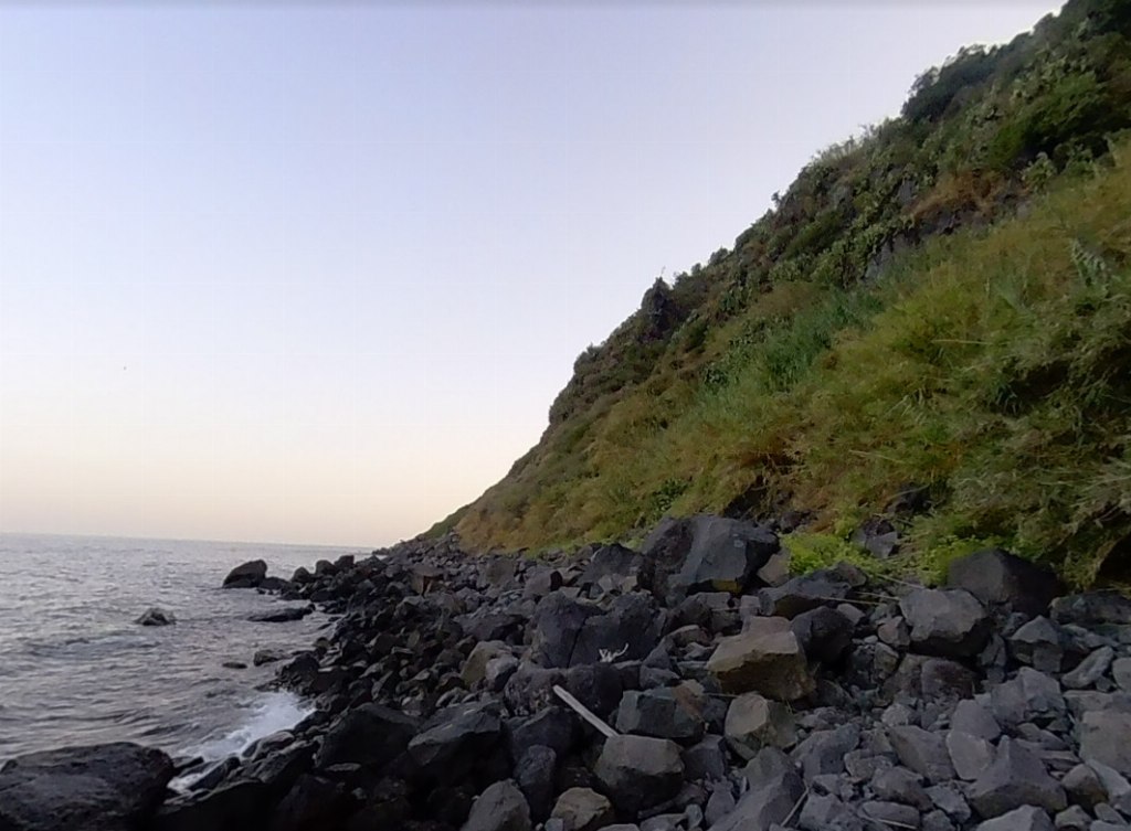
The lot, entirely fenced with the exception of the eastern border, has an irregular geometric configuration with a partly flat and mostly steeply sloping position.
The nature of the soil is of markedly lava origin, typical of the area, with a significant presence of skeleton and outcropping rock.
The land falls within the area:
1) Land circumscribed between the letters A-B-C-D-E-H-L'-M'-E'-T-U-V-A Destination: P. Detailed expansion of the Baths, in the perimeter indicated by the graphs to the East of the current thermal area, expansion allowed, safeguarding any areas to specialized crops. (art. 30 point 18 NA,). Urban indexes: dt=0. 75 m3/m2; Ac=40%. Max; Maximum number of elevations above ground: 2. Minimum distance from borders: 10.00 m. Minimum distance between buildings: 20.00 m. Minimum distance from roads: 15.00 m.
2) Land circumscribed between the letters E-F-G-H-E and M-I'-H'-L-M Destination: Z.T.O. "A2" (Historical center - art.3, art. 4, art. 40.2 paragraph 2 and art. 40.6 of the N.A.) - ART. 3 - HOMOGENEOUS TERRITORIAL AREA A. In the Z.T.O. A the interventions referred to in letters a), b), c) of article 20 of the Regional Law are allowed. 71/1978. Until the appropriate detailed plans are approved, the interventions referred to in letters d) and e) of the aforementioned art. 20. The limits of i.f.f. are the following: Z.T.O. A2; i.f.f. = 1.50 m3/m2.
3) Land circumscribed between the letters N-O-P-Q-R-S-E'-M'-L'-H-I-H'-I'-N Destination: Zone "A" of the "LA TIMPA" Oriented Nature Reserve DA n°149/44 of 23- 04-99 published in the Official Journal No. 49 of 10-15-1999. The methods of use are those provided for in the regulation attached to the aforementioned decree. Any activity must be previously authorized by the Organization in accordance with the law. Art. 18.3 N.A.
The land in question falls within the S.I.C. (site of community interest Decree 21/February/2005 published in the G.U.R.S. no42 of 07-10-2005 and subsequent amendments. ii.).
The land in question falls within the Landscape Plan (DA no031/GAB of 03-10-2018, DA n. 053/GA of 27-12-2018 and DA no062/GAB of 12-06-2019), part of the Local Landscape n . 15i in area with protection level 3) partly in the local landscape 15I with protection level 3) and partly in the local landscape 15e with protection level 2) regulated by art. 20 and art.35 of the implementing rules.
It should be noted that the land in question falls partly in the woods and partly in a forest conservation area, LL. RR. 16/96 and 13/99.
"IN ACCORDANCE WITH ART. 9 OF THE D.P.R. N. 327/2001 STARTING FROM 13 DECEMBER 2008 THE FIVE-YEAR CONSTRAINTS ON THE AREAS OF THE P.R.G. PRE-ORDER AT THE EXPROPRIATION”.
Please note the presence of irregularities inherent to the boundaries affecting parcels 229 and 676 (owned by third parties).
 Italiano
 English
 Français
 Español